Fort Lauderdale Waterfront Homes Market for Serious Boaters
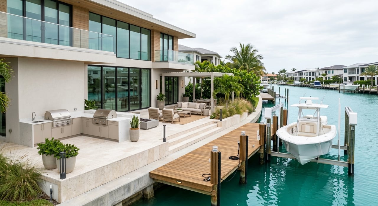
If you are searching for a waterfront home in Fort Lauderdale with serious boating in mind, the view alone is not enough. A beautiful dock behind the house can still be the wrong fit if your route includes low bridges, narrow turns, strong current, or slow-speed zones that change how you use your boat. The good news is that Fort Lauderdale offers one of the most boat-oriented residential markets in South Florida, and if you know what to evaluate, you can find a home that truly works for your vessel and your lifestyle. Let’s dive in.
Fort Lauderdale is not just waterfront by appearance. It is a deeply marine-oriented city with 165 miles of navigable waterways, plus a broad network of marinas, launch access, and pumpout services, according to the City of Fort Lauderdale marina system. That scale is part of what makes the market so attractive to buyers who actually plan to boat often, not just admire the water from the patio.
The city’s boating infrastructure is also supported by an active marine environment. Fort Lauderdale notes that 12 of its 27 marinas are designated clean marinas, and the city regularly monitors water quality at recreation-focused waterways such as Middle River, Himmarshee Canal, New River North Fork, Tarpon River, New River South Fork, and Lake Sylvia. For you as a buyer, that means the conversation should go beyond frontage and focus on how a specific waterway functions day to day.
Fort Lauderdale also sits alongside a major commercial and recreational boating corridor. Port Everglades spans Fort Lauderdale and nearby Broward locations, and NOAA’s Coast Pilot notes that several thousand yachts base in Fort Lauderdale during winter. That helps explain why this market feels different from a typical canal-home search. Here, boating access is a core part of value.
For many serious boaters, the biggest question is simple: how quickly and easily can you reach open water?
In central and south Fort Lauderdale, Port Everglades is the primary ocean-access route. Because it sits so close to many waterfront areas, homes with direct routing toward this corridor can reduce the need to navigate multiple inland bridges or slower, more congested waterways before you reach the Atlantic. In a market like this, that can make a major difference in how often you actually use your boat.
For buyers looking farther north in Broward, the equation changes. Hillsboro Inlet is another important outlet to the Atlantic, but the inlet district warns that it is hazardous, local knowledge is required, currents at the bridge can run at six knots, and moving sands can reduce depth. In other words, your access point is not just a line on a map. It is part of the ownership experience.
This is where many buyers make expensive assumptions. A home may be marketed as waterfront or even deepwater, but that does not automatically mean it works for your vessel.
According to NOAA’s Coast Pilot, New River is the main navigation channel in the area, but it also includes real operating constraints. Tarpon Bend is described as narrow, currents can be strong, and heavy traffic can be expected. The same source notes that speed in New River and Stranahan River is limited to no wake, and South New River Canal has overhead power cables with a minimum reported clearance of 10 feet.
That is why the smart question is not, “Is this home on the water?” The better question is, “Can my boat get from this dock to the ocean safely and efficiently?”
In Fort Lauderdale, bridge clearance is one of the most important filters for any serious boater. Your boat’s air draft needs to match the actual route, not just the dock address.
There is also an important caution here. Broward County’s boating guide says bridge clearances are only a guide and should not be relied on for navigation. Some published figures also vary between official sources, which means you should always verify the route before you move forward on a purchase.
Here is a quick look at several key bridges commonly discussed in Fort Lauderdale boating routes:
| Bridge | Published Clearance | Opening Notes |
|---|---|---|
| Southeast 17th Street Causeway | 55 feet | Opens on the hour and half-hour |
| Las Olas Boulevard | 24 to 31 feet depending on source | Opens on the quarter-hour and three-quarter-hour |
| Sunrise Boulevard | 25 feet | Opens on the hour and half-hour |
| Oakland Park Boulevard | 22 feet | Opens on the quarter-hour and three-quarter-hour |
| Davie Boulevard | 21 feet | Opens on signal except weekday commuter windows |
| SW 11th Avenue Swing Bridge | 3 feet | Very restrictive for many vessels |
The Las Olas Boulevard Bridge is a perfect example of why verification matters. NOAA lists 24 feet at the center, while Broward’s boating guide lists 31 feet at mean high water. If your vessel is close to that threshold, a small difference on paper can have a major effect in real life.
Even if your boat technically fits the route, speed restrictions can change how practical that route feels.
FWC defines Idle Speed – No Wake as the minimum speed needed to maintain headway and steerageway. Slow Speed, Minimum Wake means your vessel must be fully off plane and completely settled in the water. In Fort Lauderdale, those definitions matter because several active waterways include restrictions that shape travel time and handling.
NOAA and Broward guidance tie New River and Stranahan River to no-wake operation. Broward also notes that a year-round slow-speed, minimum-wake restricted area now applies in the Intracoastal Waterway between the Oakland Park Boulevard Bridge and the Sunrise Boulevard Bridge. If you plan to go out often, those details belong in your buying decision, not just your closing checklist.
The home may be perfect, but the dock setup still has to support your ownership plans.
Broward County says docks, seawalls, floating vessel platforms, and other in-water structures require an Environmental Resource License. The same county guidance explains that marine facilities with five or more slips require a Marine Facility Operating License, while waterfront single-family homes and smaller multi-slip facilities are treated differently under the county’s Manatee Protection Plan.
That distinction matters if you are thinking ahead. A property that works beautifully for one vessel today may not be easy to reconfigure tomorrow. Broward also states that, as of February 21, 2020, no slips were available for allocation in the South Zone, which is a meaningful caution for buyers who assume they can simply add more dockage later.
For serious boaters, maneuverability can be just as important as frontage length.
Official sources often focus on narrow channels, current, and obstructions instead of offering one simple width standard. That is especially relevant in places where turning room is tight or traffic is heavy. A long dock behind a house is helpful, but it does not tell you whether your captain can comfortably back out, turn, and move through the canal with confidence.
It also helps to understand whether the home sits on a quieter residential stretch or a more active boating corridor. The City of Fort Lauderdale waterway monitoring page references waterways such as Middle River, Himmarshee Canal, Tarpon River, New River South Fork, and Lake Sylvia, which shows how varied local water conditions can be across the city.
In certain waterfront areas, local district oversight adds another layer to ownership.
For example, the Lauderdale Isles Water Management District manages 10 canals and part of the North New River Canal, with responsibilities tied to canal depths, obstructions, debris, boat safety, and dredging. That does not make an area better or worse. It simply means your waterfront ownership experience may include district-specific considerations that you should understand before buying.
This is another reason a boating home search should start with the waterway itself. Once you understand the route, bridge path, and local operating conditions, the property shortlist becomes much more meaningful.
If you want a Fort Lauderdale waterfront home that truly supports your boating lifestyle, focus on these questions early:
In Fort Lauderdale, the best waterfront home for a serious boater is rarely chosen by architecture alone. It is chosen by the full picture: the waterway, the bridge route, the inlet access, the speed zones, and the dock realities that shape everyday use.
That is where a more strategic home search makes all the difference. If you want help identifying Fort Lauderdale waterfront homes that align with your vessel, your goals, and your preferred boating lifestyle, connect with Isabela Faria for a personalized consultation.

Whether buying or selling, Isabela delivers service beyond comparison. Isabela works closely with each of her clients to find their ultimate property in the most premier locations, and secures the best deal. When listing a property, Isabela maximizes each property’s market value with her unmatched marketing strategy.
Let Me Know How I Can Assist You
ISABELA FARIA-NEWELL
7401 Wiles Rd., Suite #236 Coral Springs, Fl 33067